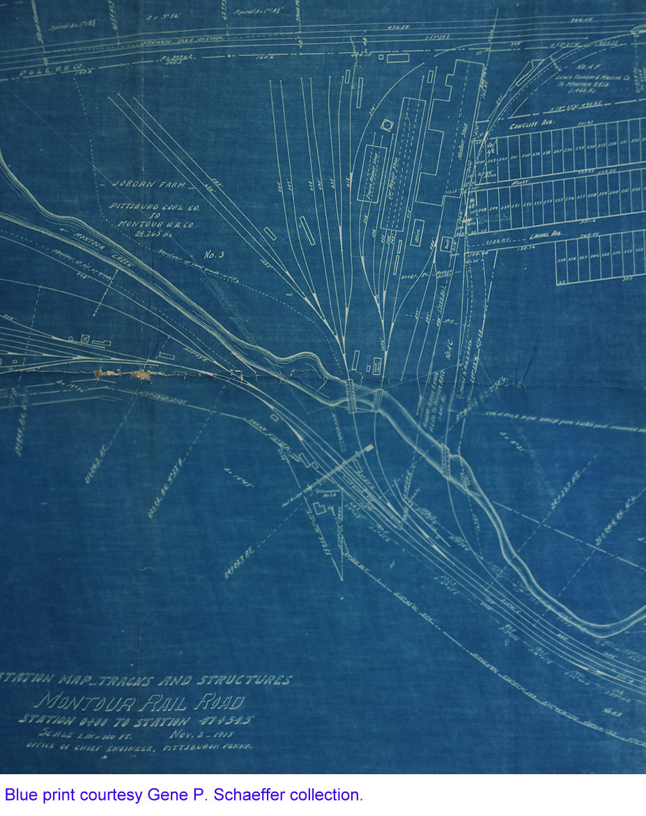
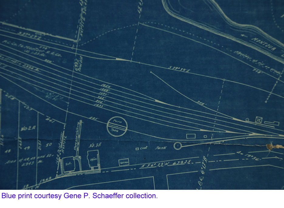
Blueprints
courtesy Gene P. Schaeffer collection
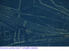
The Lower Yard
at Montour Junction - location of the blue print images, was
re-configured, I'm guessing the 1930's. The Turntable was no doubt used
to turn the Engine for the Passenger Train, and after the demise of
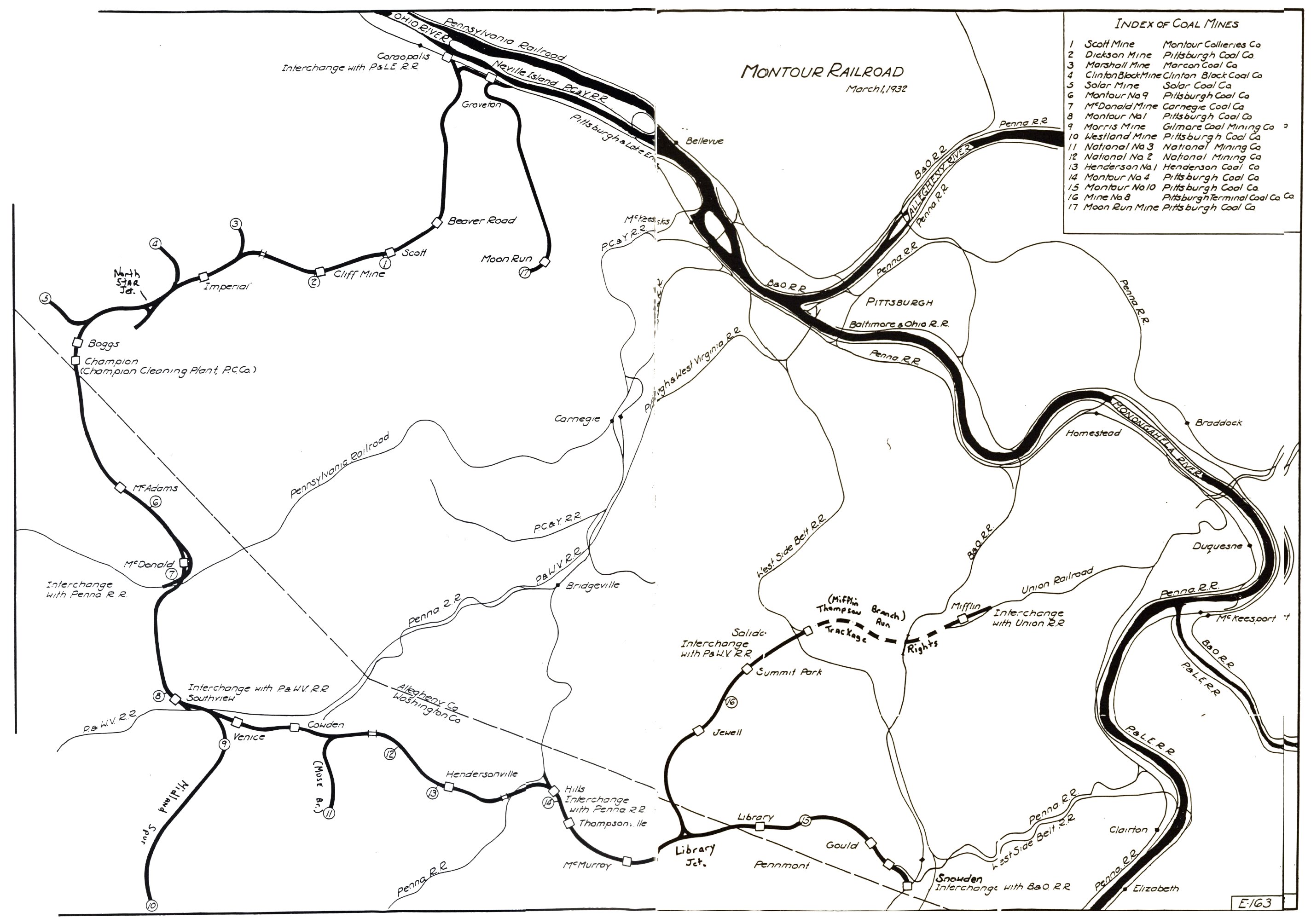
Passenger Trains, its use was no longer needed. At Imperial there was
the "wye" for turning before the "wye" at North Star. The original Main
Track in the Lower Yard down to the P&LE was rebuilt
eliminating the "Siding" seen in the blue prints. That siding was
primarily used to hold the Passenger Trains between runs.
I have 2 very old 8x10's taken from under the overhead streetcar bridge
near the P&LE showing the West End of the Lower Yard and Main
Track Siding switch and lead to the yard tracks. These are dated 1917
and came from a Professional Photographer the railroad hired when a
young boy was killed playing near the tracks and resulting
lawsuit. The rebuilt Lower "New" Yard at Montour Junction had
just 3 tracks...Main - New 1 and New 2. In the blue print showing the
turntable - to the right you see the word "tank" and to the right of
that a circle with a track ending in it.
If you have a older Montour RR Timetable, look at Station 5A. This was
station 5A which was a ramp track for No 9 retail yard. Hoppers of coal
were brought to Montour Junction and shoved up on the ramp for
unloading. Residents who bought coal for heating in and around
Coraopolis, no doubt purchased their coal from Pittsburgh Coal,
No 9 retail Yard transloaded coal from railroad cars to
delivery dump trucks.
And next to 3A in the turntable blue print you see the squares reading
"Office". This was the location of the 2 homes the Montour Railroad
used as General Offices from about 1915 to the late 1960's.
Gene P. Schaeffer
|
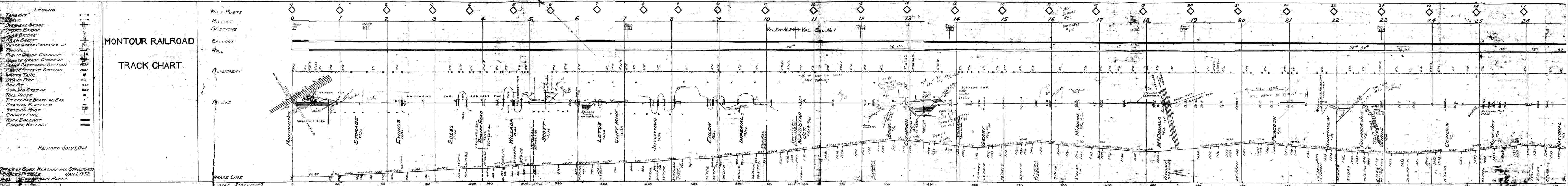
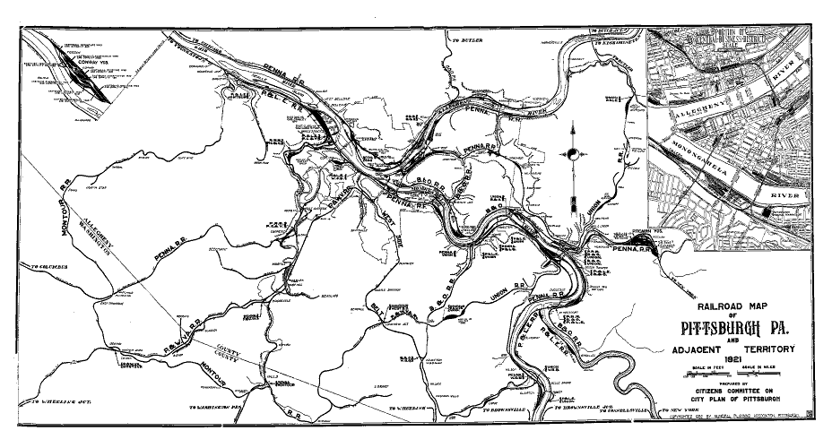
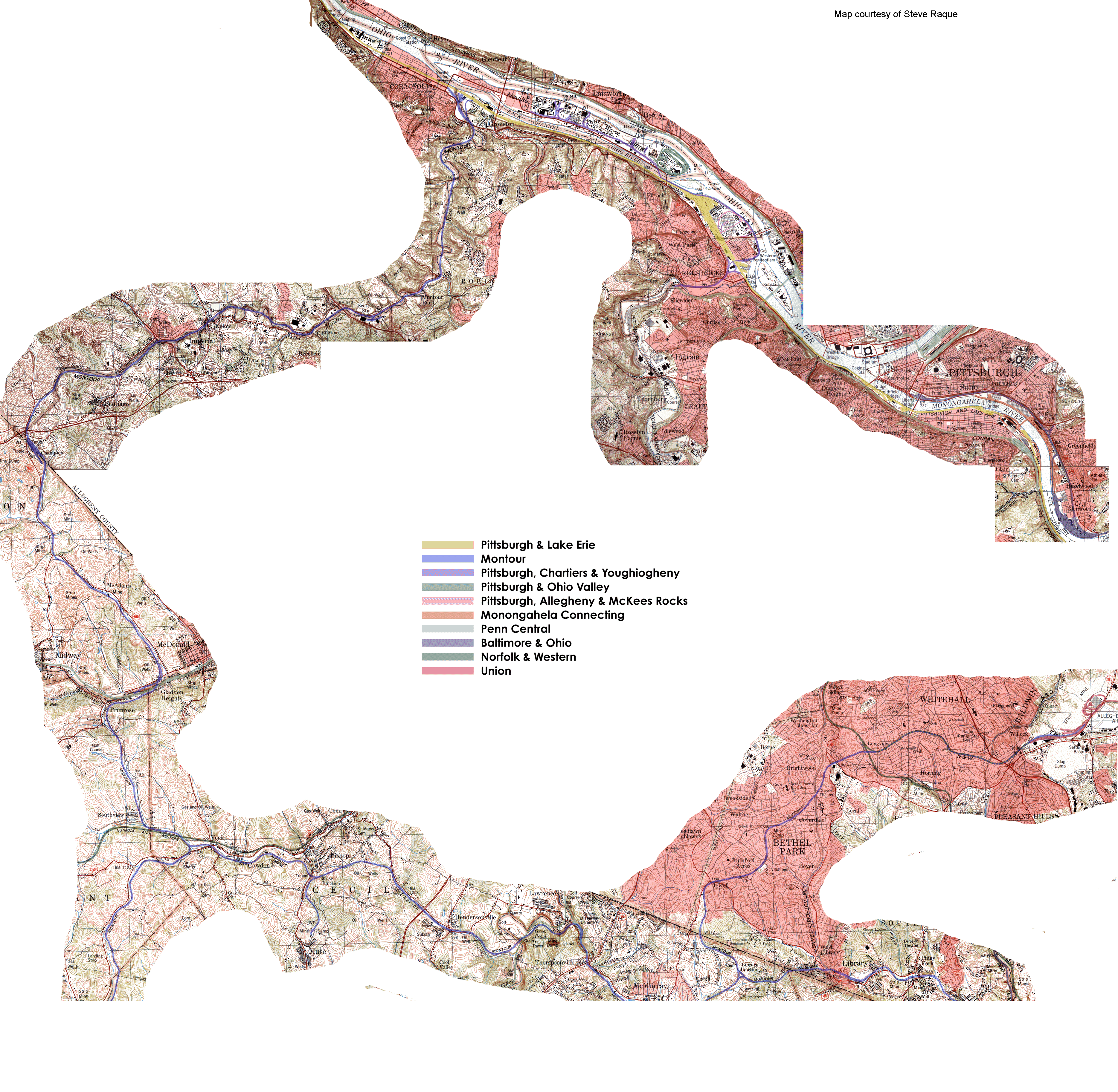
 Montour
Railroad
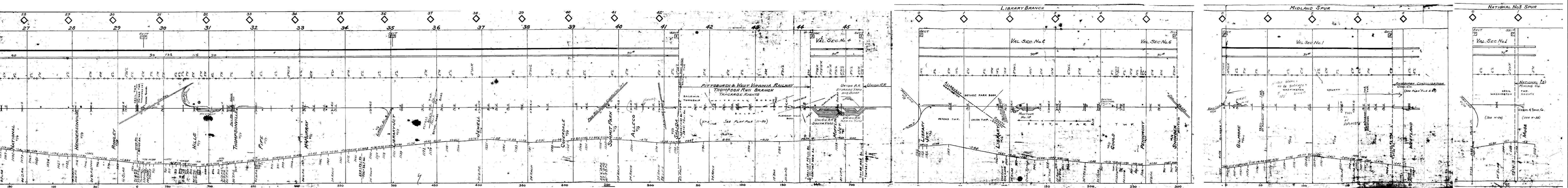
Montour
Railroad