Montour Railroad 


Montour Railroad

Mileposts

History

Maps

Roster

Mines

Links

Gallery

Working on the Montour

Employees

Railroading 101


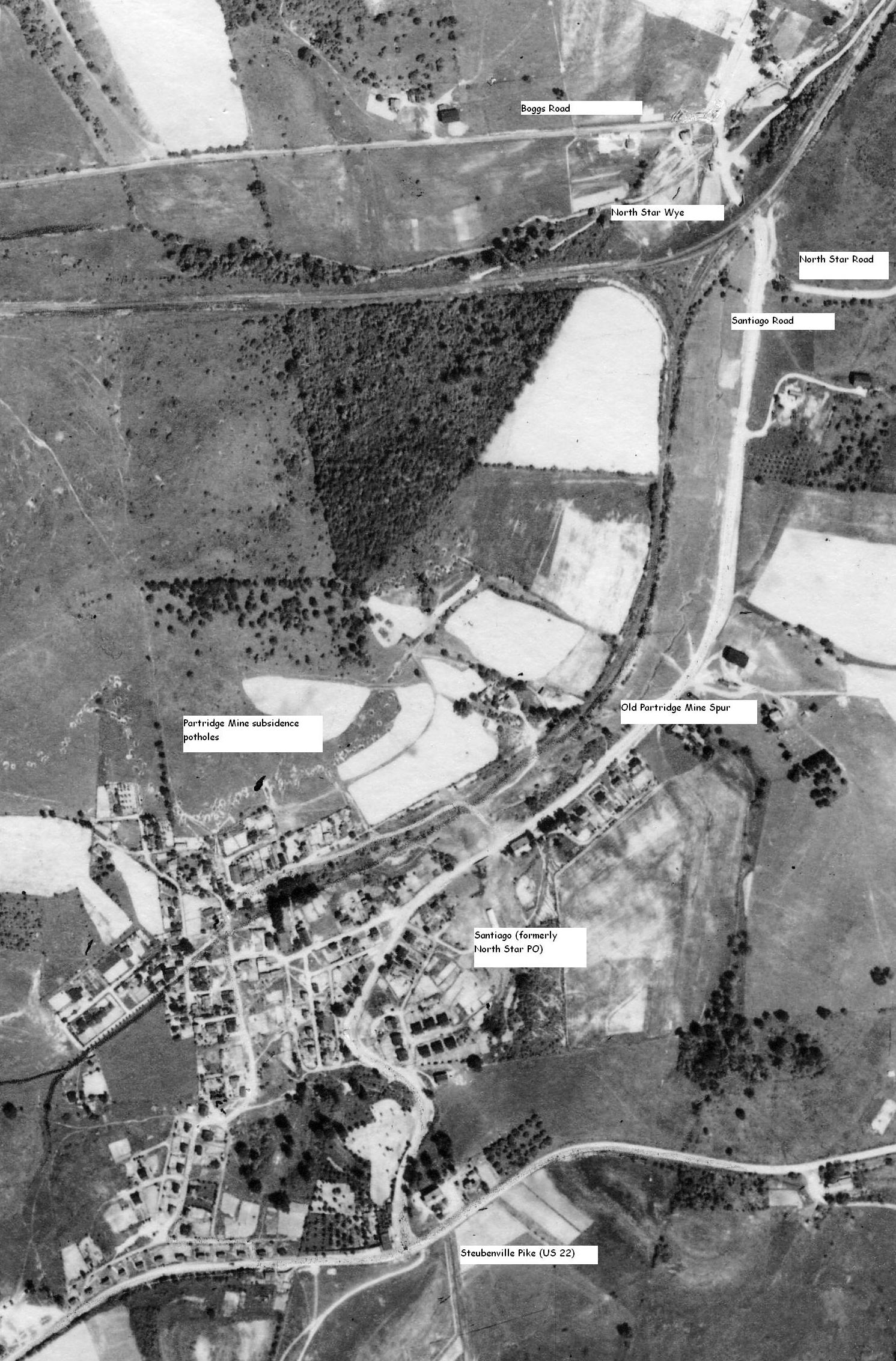
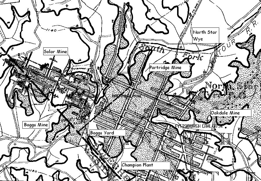
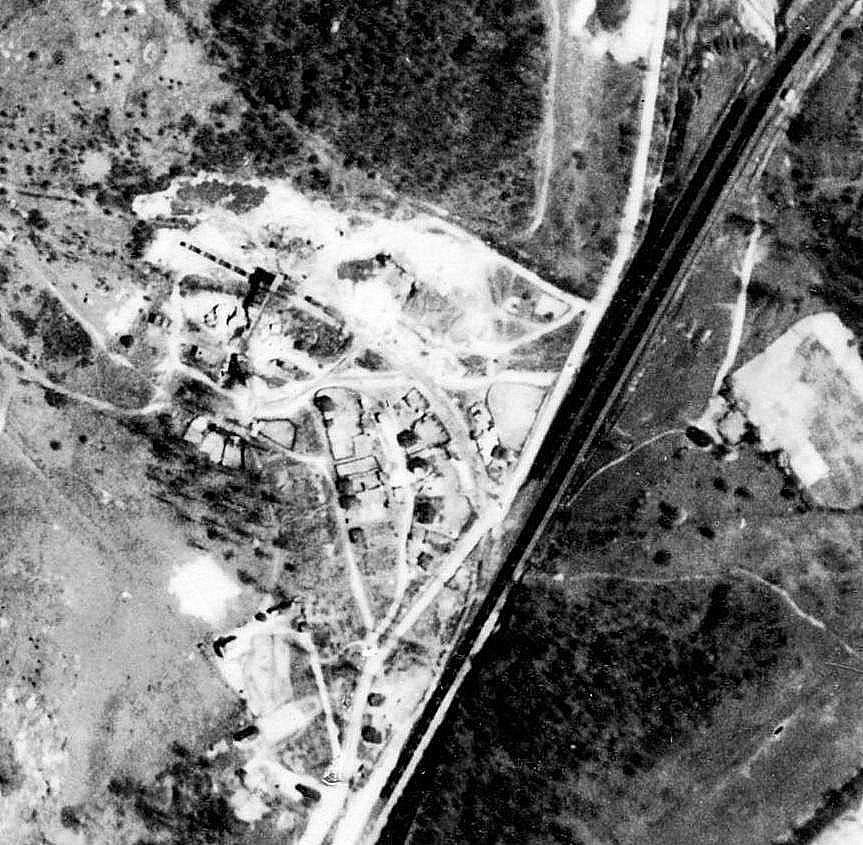
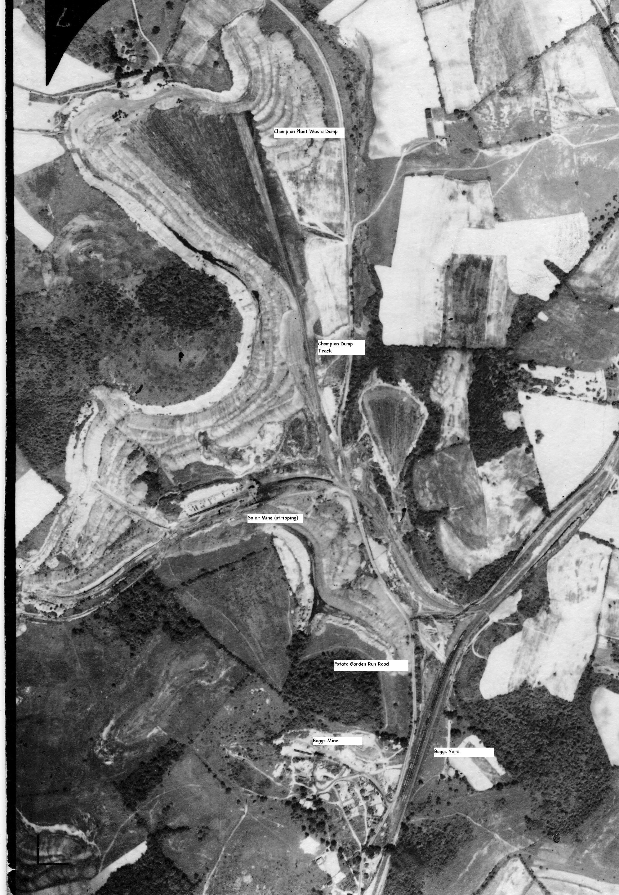
Boggs Mines

Bob Ciminel's report on the Boggs Mine.

The Boggs Mine was located south (timetable east) of Solar Mine and north of U.S. Route 22.  It was a slope mine, owned by the Montour & Lake Erie Coal Company, headquartered in Pittsburgh.  There is very little information about this mine, suggesting that it may have been known by another name during its lifetime.  The mine was eventually taken over by the Pittsburgh Coal Company.  There is a reference to a Montour & Lake Erie Mine No. 1 in the records at the same location as Boggs Mine.

Boggs Mine was located at the east end of Boggs Yard and reached through a facing point switch off of the yard tracks.  A loading platform was located 420 feet west of the grade crossing over Potato Garden Run Road.  Boggs Mine was listed as Station 82 in the 1940 Montour employee timetable.

To add further confusion, the M&LE Coal Company Mine No. 1 was supposedly serviced by the M&LE Railroad, which never existed.  To top
it all off we have a listing below that shows the Boggs Mine being serviced by the M.G.A Railroad, the reporting marks for the Monongahela Railway. However, we can probably assume that the M&LECCo was run by Mr. James Boggs, and that the mine was named after him; that it truly was a slope mine and the Pittsburgh seam at the mine’s location was about 5 feet thick (that was the average thickness for the seam in western PA). The daily capacity of 400 tons seems very low when you consider that the older Montour mines (Dickson and Cliff) were producing up to 1,000 tons per day using picks and shovels.

Montour & Lake Erie Coal Co.
Flannery Bldg., Pittsburgh, Pa.
Pres. ...... James S. Boggs
Boggs Mine
P.O. ......... Imperial, Allegheny Co., Pa.
Ship ......... Boggs, M. G. A. R.R.
Seam ......... Pittsburgh 64 in. Thick
Kind of Opening ......... Slope
Daily Cap ..........400 T

Boggs Mine is listed on the 1940 Montour Railroad employee timetable, but only as a loading platform, not a tipple, indicating that coal was being loaded from trucks.

These maps show North Star and the Partridge Mine, as well as Boggs Yard, Solar Mine, Champion waste dump, and Boggs Mine. The coal seam at Partridge was around 1120 ft MSL, 1150 at Solar and around 1160 at Boggs Mine. These were all drift mines.  The railroad came into the North Star Wye at about 1020 ft MSL and was at approximately 1135 ft MSL when it rounded the curve into Boggs Yard.  I don't have my Montour track chart with me, so the railroad elevations are just a guess. 


Partridge Mine 1939 Aerial photograph


This mine map shows the spur leading into Boggs Mine (the Champion coal washer would be at the top of the map) and also shows that the Pittsburgh Coal Company was the original landowner of 7 acres.  The slope entry is also shown.  Note that the mine also extended north via an entry under the loaded yard track.  Solar Mine would be at the bottom of the map.


Here's a view of Boggs Mine and Yard taken in 1939, courtesy of the Penn Pilot web site. According to the 1940 timetable, Boggs station was 12.58 miles east of Montour Junction and 32.31 miles west of Mifflin Junction. The mine's loading platform was 420 feet west of the highway crossing at Potato Garden Road and would not clear a man hanging on the side of a car.  The Boggs tipple would not clear a caboose or boxcar. Boggs Mine was Station #82 with an East End Connection off of Boggs Yard, and it was equipped with a derail. From the photo, we can see that Boggs was still an active mine in 1939.


Solar and Boggs Mine Area