 Montour Railroad
|
|
Clinton No 1 Mine Bob Ciminels Clinton No 1 Mine Report Clinton Block Mine After
leaving Imperial and crossing Route 30, we make a slight detour up the
Clinton Block Spur to the Clinton No. 1 Mine about two miles up the
tracks. The spur was built by the Clinton Block Coal Company in
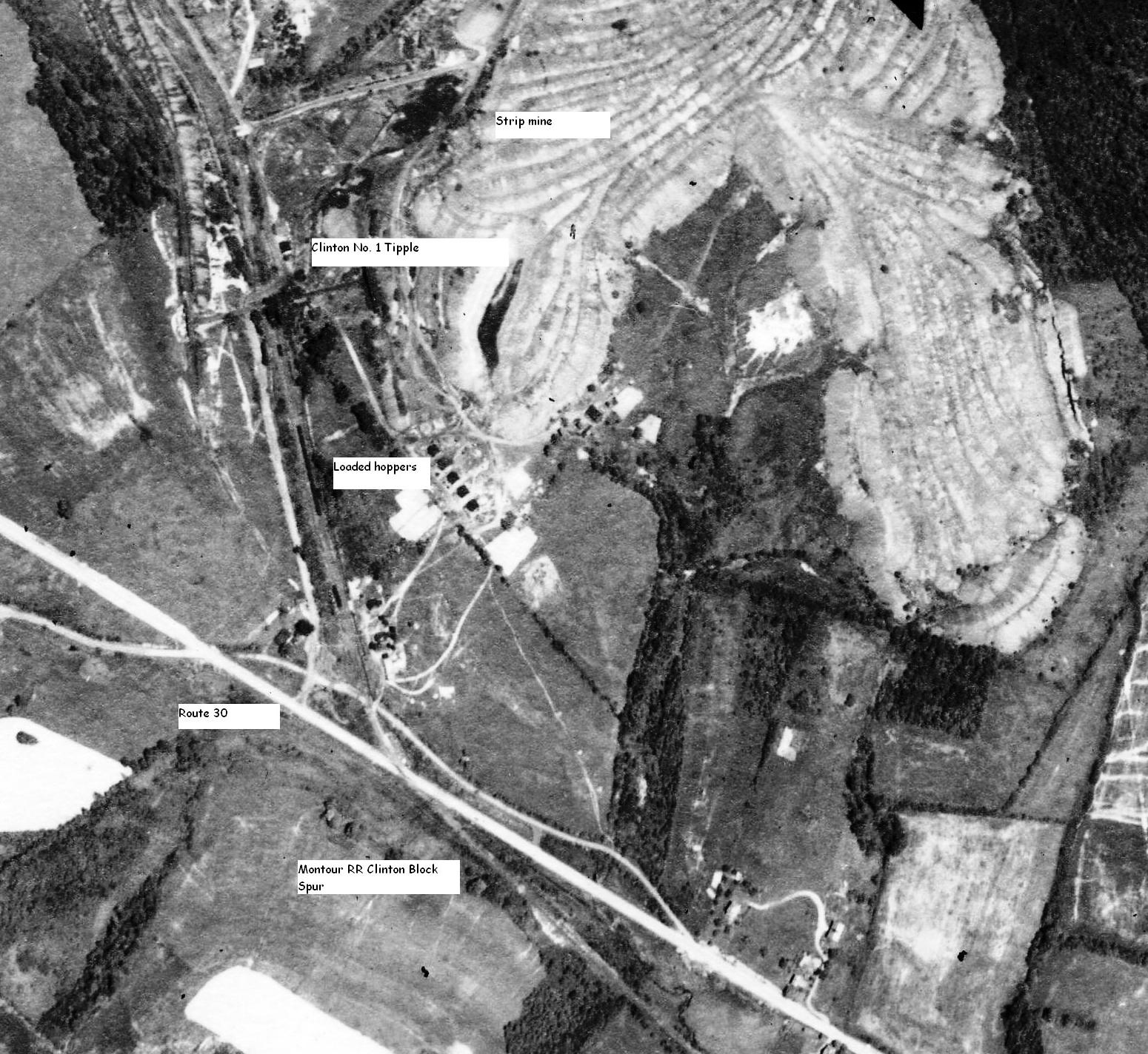
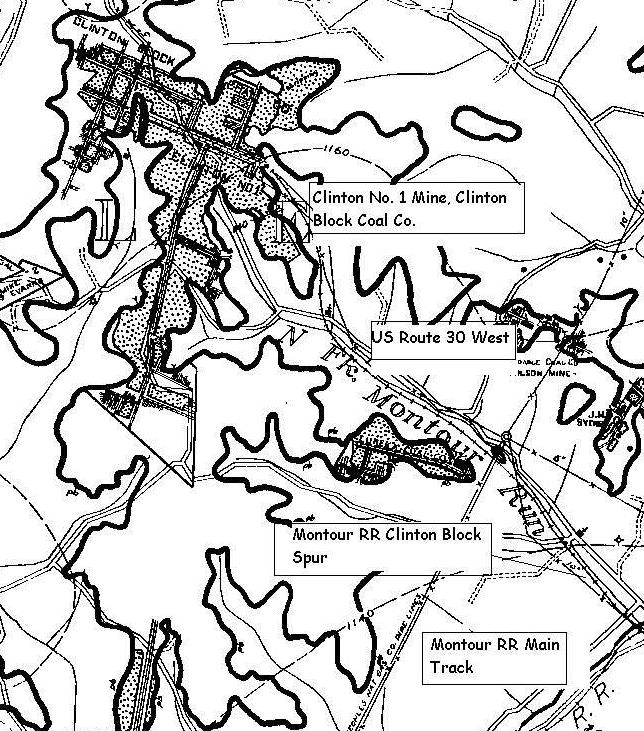
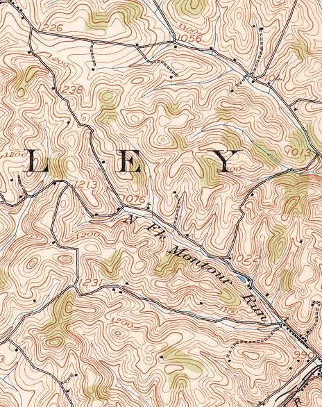
1917 when the mine was opened. Clinton No. 1 Mine was not technically “along the Montour,” it was located about two miles up the Clinton Block Spur on the north side of U.S. Route 30. The mine was owned by the Clinton Block Coal Company (CBCCo), which was incorporated on October 26, 1917 with a capital of $600,000 by Robert McCarrell of Washington, PA. By 1918, the company also began a strip mining operation on land east of the original mine site. The Clinton Block Spur left the Montour main track a short distance east (railroad) of the Route 30 overgrade bridge and followed the North Fork of Montour Run on the west side of Route 30 to a grade crossing just south of the Burgettstown Road intersection. The old right-of-way going up to the mine is about a tenth of a mile beyond the entrance to the Findley Township Sports Complex. A passive acid mine drainage treatment facility was built on the old mine site in 2008 coincident with the construction of the Route 576 toll road. Trains using the Clinton
Spur (later named the Clinton Block Branch) would have to run by the
trailing point switch at Clinton Block Junction, Milepost 9.97 (Trail
Milepost 9.0) and then back into the spur and shove up to the mine. In
addition to the Clinton No. 1 mine not being along the railroad, the
Montour also did not own the spur. It was built by the CBCCo in
1917. At the time the branch was built, Clinton No. 1 Mine was also operated by the Lebanon Block Coal Company of Imperial during part of 1920, but the CBCCo was the primary owner during the life of the mine. The mine was eventually taken over by the Pittsburgh Consolidation Coal Company around 1946. Clinton No. 1 began as a drift mine with workings on both sides of Route 30, but also operated as a strip mine. Underground workings primarily worked the coal to the northwest and southwest, with the stripping operations working to the northeast. The tipple and rail spur were still serving the mine in 1939. The Pittsburgh coal seam did not extend beyond the town of Clinton, although several small mines operated along Clinton Road. However, the Clinton No. 1 Mine was the primary exploiter of the seam between Imperial and Clinton, with the workings extending southwest to the intersection of Robinson and Burgettstown roads. The coal seam at Clinton No. 1 was located about 1,160 feet above sea level and surface elevations were between 1,080 and 1,200 feet. This resulted in a self-draining drift mine that could easily be converted into a strip mine with only 40 feet of overburden needing to be removed to reach the coal. Having the tipple and railroad spur already in place alsoimproved the economics of the strip mine. These are maps of the Clinton No. 1
Mine on the Clinton Block Spur.
|