 Montour
Railroad
Montour
Railroad
|
|
|
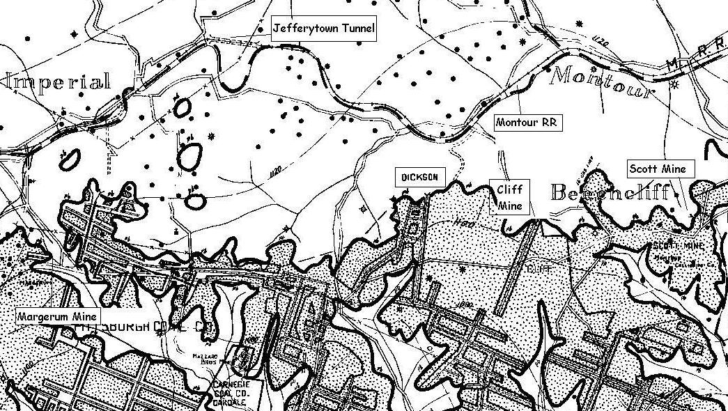
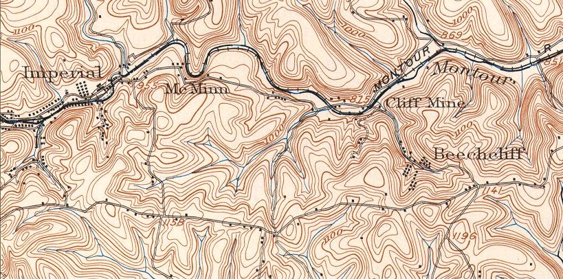
| Early Montour Mines The Pittsburgh Seam cropped along the southern wall of the Montour Run valley at between 1,100 and 1,120 feet MSL. Ground elevations along the creek were around 840 feet MSL, so the Imperial Coal Company had a relatively easy job of opening drifts into the seam and using gravity to drain the mines and move the coal down to the railroad. Add to that the short downhill run to the coke oven and Montour Junction and you can see why the railroad was a solid moneymaker for the coal company. The mine map is from the 1930s; the topography map is from early 1900s.
|