 Montour Railroad
|
|
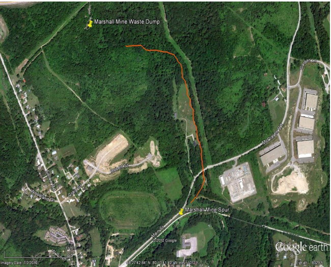
Margerum Mine Margerum Strip (Dis. 2) Ship Champion, Montour RR Supt. Frank Murget Strip PGH Seam: 62" Th. Mng. Equip.: 2 Ldg. Shvls.: 1 Drag.: 2 Ovbdn Drils: 2 Dzrs.: 7 Pumps.: 6 Util. Trks. Prop. Owned: Life Expec. 4 yrs.: Emplys 10: 2 shifts Daily Cap. 500 T. 1963 Tonnage, 117,879 (Westland Strip) Note: Margerum Strip started in 1964 As we enter Imperial, a spur to the Margerum Mine crossed over Patterson Road and then paralleled Church Road to the tipple located across from St. Columbkille Church. The remnants of the spur’s grade form an alley behind the Lighthouse Bar at 390 Route 30 as the road curves to the left to pass beneath the former Montour right-of-way (Trail Milepost 8.5). In 1898, the Margerum Mine was operated by the Morgan, Moore & Baine Company of Imperial, but was taken over by the Pittsburgh Coal Company after it was organized in 1899. Records show the PCCo operated the mine between 1900 and 1920. Mr. George W. Schluederberg was the Margerum’s General Superintendent from 1900 to 1901. The next General Superintendent was J. M. Armstrong in 1917. There is no record of who was General Superintendent between 1901 and 1917, or after 1917. Margerum had at least five Superintendents between 1898 and 1917, but there are also gaps in those records. The following men ran the mine on the dates shown: C. G. Newton, Superintendent, 1898 J. E. Crouch, Superintendent, 1900 W. L. Murray, Superintendent, 1901 to 1903 F. B. Dunbar, Superintendent, 1905 W. M. Garrett, Superintendent, 1917 The Works Progress Administration mine maps show the Margerum and the Montour mines located concurrently on the west side of Route 30. This may indicate that they were the same mine, or were merged after opening. Records indicate that the Montour Mine had three different names over its history: Montour, Imperial and Montours. Originally opened in 1878 by the Imperial Coal Company, the Montour/Margerum complex remained with the ICC until at least 1898. The PCCo purchased the ICC in 1900/1901. As with all of the mines on the east bank of Montour Run, the coal seam was located between 1100 and 1200 feet above sea level, or about 150 feet above the Montour Railroad’s main track through Imperial. The Margerum Spur followed a small creek that flowed along the west side of Route 30 before passing under the highway and following Church Road down to Montour Run. Margerum Mine was a large mine that operated two sections, one passing under Steubenville Pike and following the coal seam southwest toward the North Fork of Robinson Run and the other extending to the northeast under West Allegheny Senior High School, which, by the way, is built on the former location of the Margerum mine dump. This Google
Earth image shows the location of the Margerum Mine as it exists today,
with a rough approximation of where the spur was located.
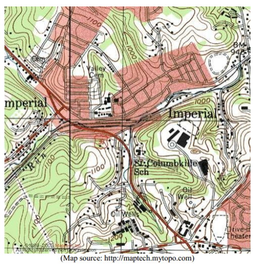 This 1905 topographical map shows the Margerum Spur. 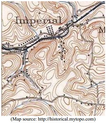 This 1938 aerial photo shows the remnants of the Margerum Spur and the mine’s two waste dumps - and miner’s housing. 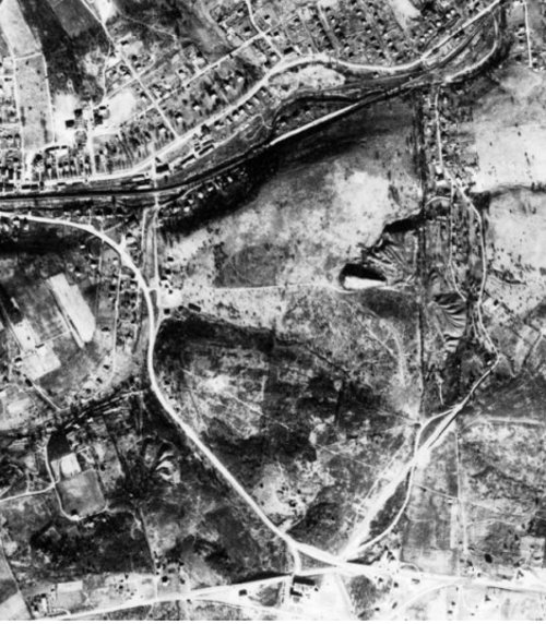 This WPA mine map shows the old Margerum workings as they existed in the early 1930s. 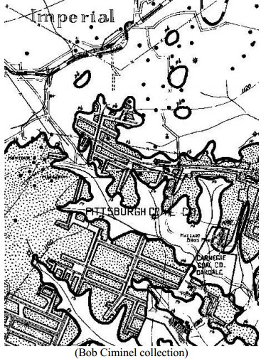 |