 Montour Railroad
|
|
Marshall Mine
The Marshall Mine, northeast of Imperial, was opened by the Marcon Coal
Company around 1920. The mine was serviced by the Montour
Railroad via a spur on the north side of the main track west of
Jefferytown Tunnel. The track followed McLaren Road for a
short distance before turning north and following a creek up to the
mine site.
The mine maps show that Marshall Mine had approximately six drift entries along the eastern side of the outcrop, between 1,145 and 1,155 feet MSL. The railroad was at approximately 920 feet MSL, which means the spur climbed about 80 feet over a distance of 0.5 mile for an average grade of 3%. After passing through Jeffreytown Tunnel and just before reaching Enlow, we come to the siding and spur that served the Marcon Coal Company’s Marshall Mine, one of the lesser known mines along the railroad. The records on this mine are sketchy at best, but we do know it was operating in 1920. It was taken over by the Schade & Silveus Coal Company in 1930 and was sold again in 1931 to the Sillman Coal Company and renamed the Sillman Mine. Production records for 1931 show that the mine produced about 36,000 tons; operated for 156 days that year and had 40 employees. The mine was not listed in the production records for any of the following years, and the 1938 aerial photo of the area shows the mine abandoned. Early maps of the Montour show a spur leading up to the mine, which was located north of McClaren Road, east of Enlow Road and just south of the present location of I-376. The spur to the mine came off of the Montour main track at the railroad east end of the curve at the exit from Jeffreytown Tunnel where the track paralleled McClaren Road. After crossing McClaren Road, the spur followed an unnamed stream northward, ascending about 120 feet in elevation from the Montour main track to the mine tipple. As with most mines along the Montour that had lengthy spurs to reach their tipples, the roadbed and track was probably owned, built, and maintained by the mining company.
This is a link to a
satellite view of the spur and mine site.
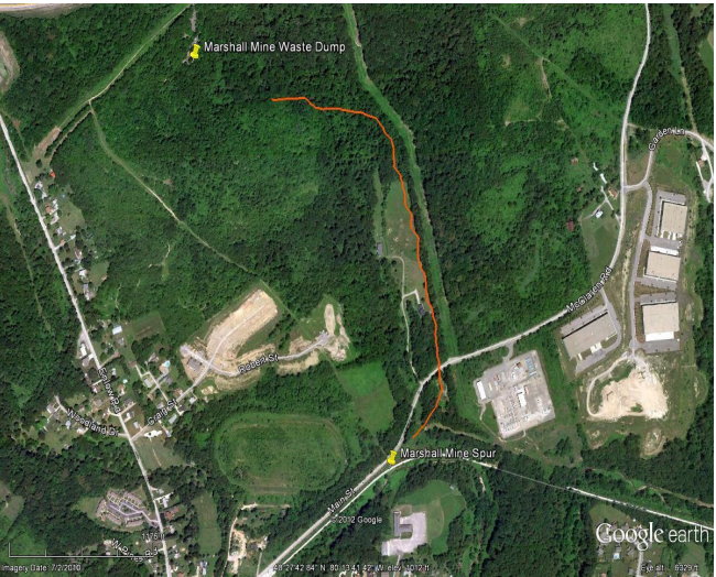
Click on the image for higher resolution This Google Earth image shows the location of the Marshall Mine as it exists today, with a rough approximation of where the spur was located.
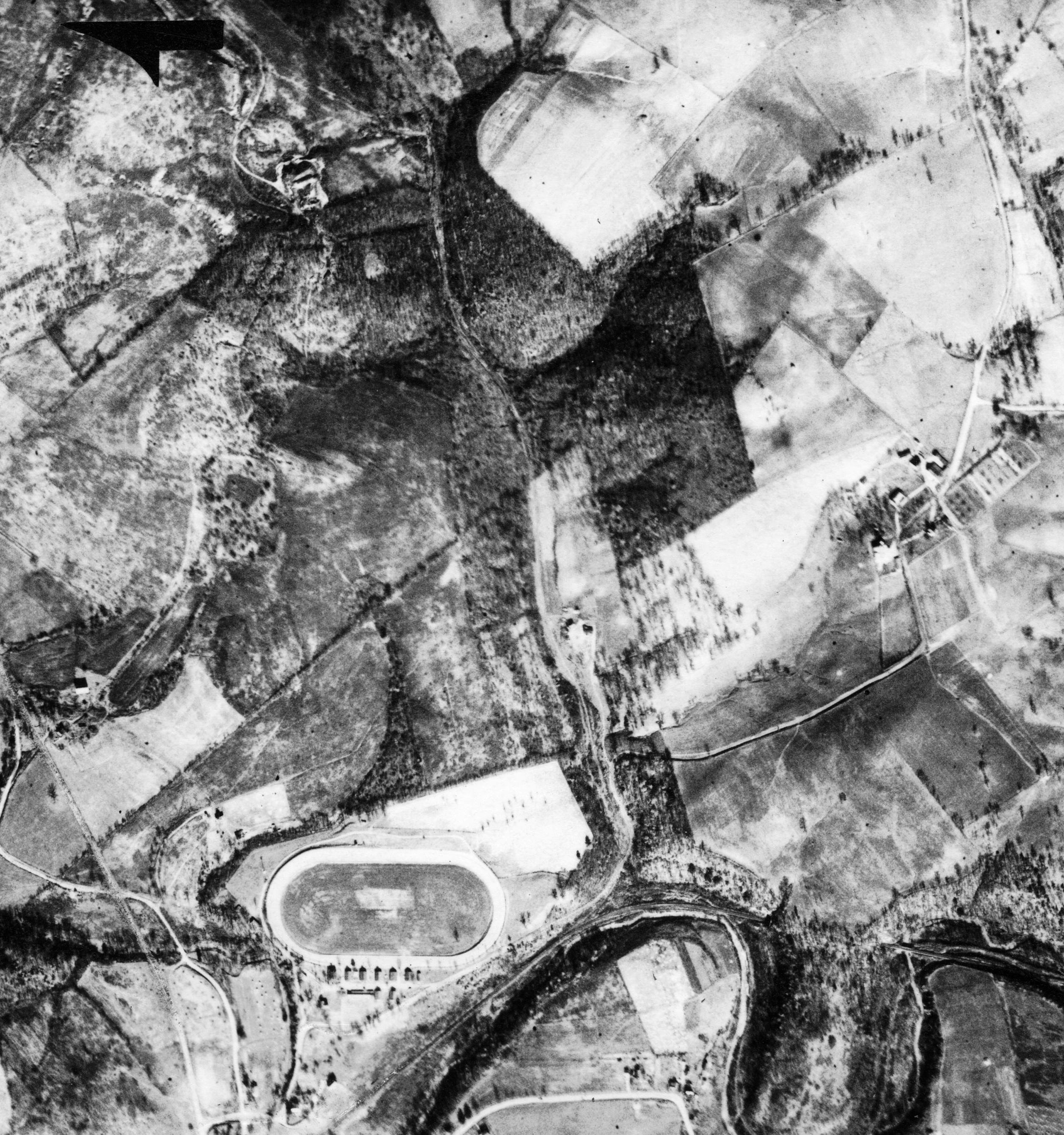
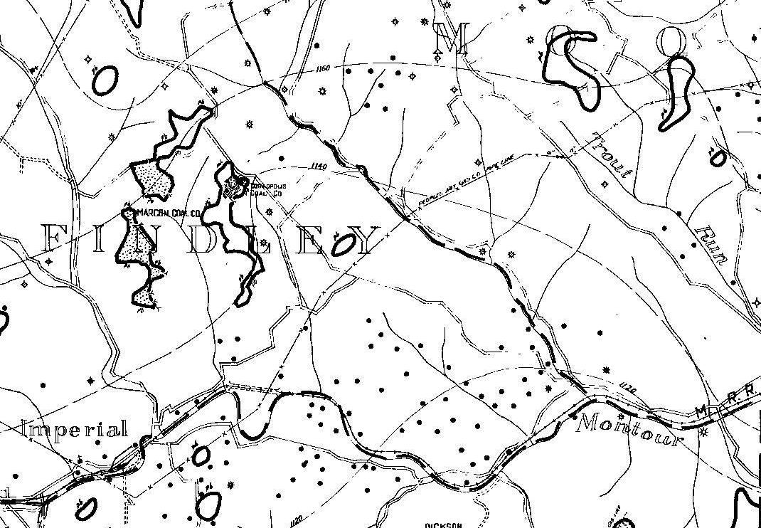
The image is from the Penn Pilot web site showing the Marshall Mine as it existed in 1938, after abandonment. The mine workings are at the top, left of center, with McClaren Road and the minespur to the east of the race track. This is a Works Projects Administration map from the 1930s showing the mine and its multiple entries into the Pittsburgh coal seam.
|