 Montour
Railroad
Montour
Railroad
|
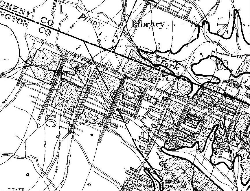
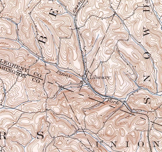
| Montour # 10 Bob Ciminel's report on Montour #10. Montour
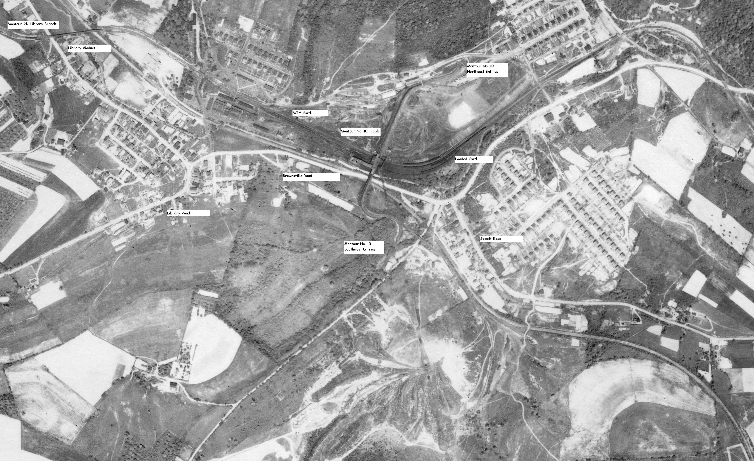
No. 10 Mine was Station 148 at MP 36.84 in the 1940 timetable.
The speed limit between Library Junction and Snowden was 15 mph and
retainers had to be set up on 75% of loaded cars traveling between the
junction and Library. There was a crossing watchman on duty at
Montour No. 10 from 8:30 a.m. to 4:30 p.m. Monday through Friday, and
between 11 a.m. and 3 p.m. on Saturdays. No watchman was on duty
on Sundays and holidays. In the 1948 timetable, the watchman's
hours were changed to 8:30 a.m. to 4:30 p.m. Monday through Saturday. The Montour #10 Mine was on the western edge of the Amity
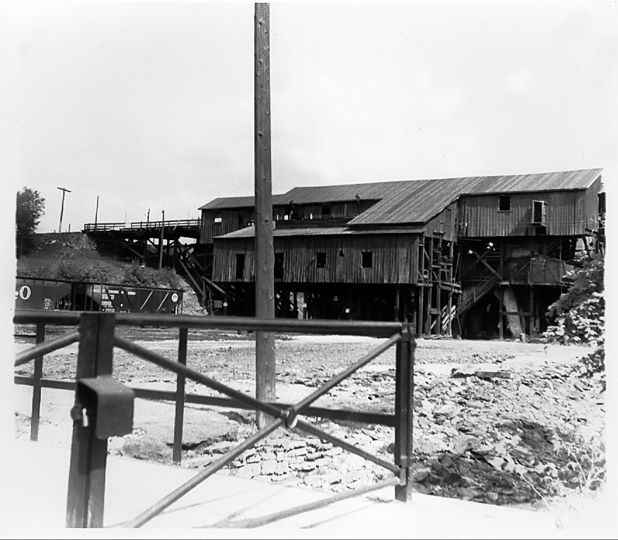
Anticline and the coal seam rose from 860' MSL at the mine's western boundary to
over 1,050' MSL at its eastern boundary. The mine had two main entries
into the valley wall on each side of Piney Fork. The seam was about 1000'
MSL there with the tipple at around 960' MSL. That's why the coal cars
traveled on trestles into the tipple. Piney Fork had cut into the
anticline, exposing the seam on both sides. A great place to put a mine!
The McMurray Syncline and the Amity Anticline are why Montour No. 4 was a shaft
mine and Montour No. 10 was a drift mine.
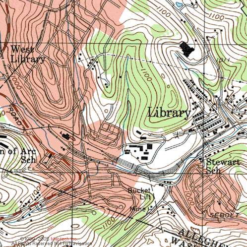
The entry to the West Mains for Montour No. 10 went under Cardox Road.
There was a trestle across the road northeast of the mine entry that went to
the waste dump on the other side of Cardox Road.
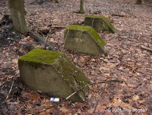
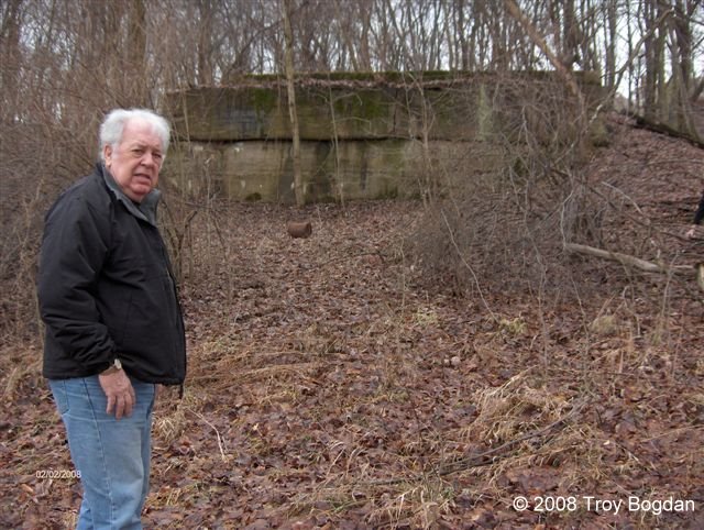
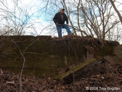 RJ Lane standing on the Cardox Trestle remains There was what looked like a trail or some kind of ROW going down from the main ROW toward those three blocks of concrete in Troys photo shoot. There was a lot of coal on the ground here and what looked like part of a mine car switch [small spikes] frozen in the ground this location - Carter Roth
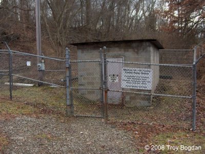
The Montour #10 and #4 pumping station is part of the mine drainage system
CONSOL has to maintain to keep the two mines from overflowing into Chartiers
Creek. The creek is the low point for both mines. Montour No. 10 is higher
than No. 4, but the breeched barrier that cause No. 4 to flood in 1980 have
essentially turned both mines into a single mine.
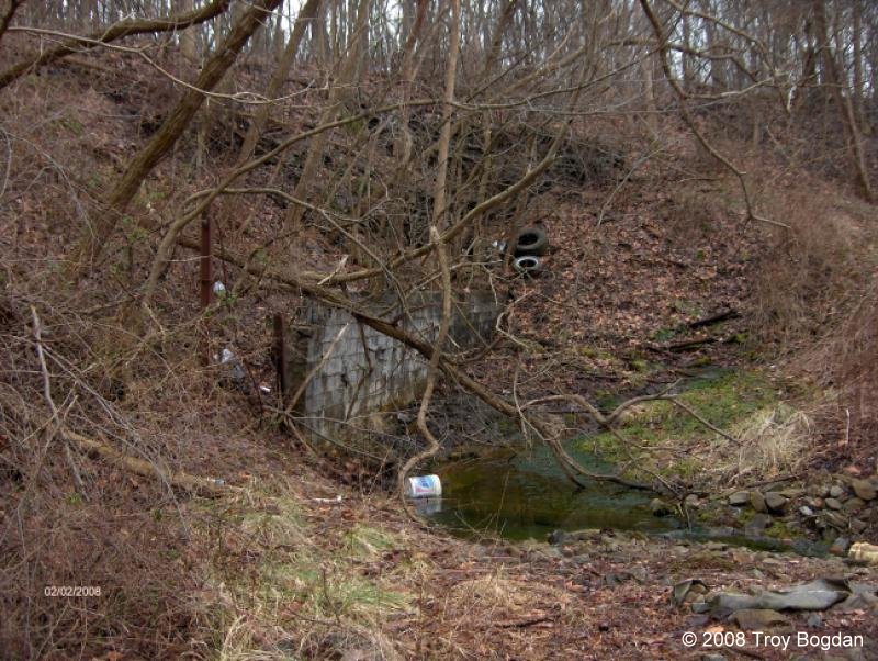
What looks like a mine entrance just to the left of this photo was a CB retaining wall against the hillside going back into said hillside. This is what looked like a dirt mine seal and this seal at ground level was the water discharge. The actual seals for the East and West Main are far back into the hillsides. They backfilled out to the surface after the concrete seals were installed.
I agree with you that there was an old mine entrance here next to the concrete block wall. It is now all blocked with a big pile of dirt. I could see a little bit down into the mine in a little "groundhog" hole above the dirt fill. There was a lot of water coming out of here. - Troy Bogdan
|