 Montour Railroad
|
|
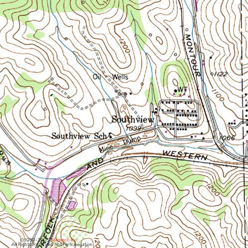
Montour No. 1 Bob Ciminels' Montour No. 1 Report. Unfortunately,
there are no timetables showing how the Montour handled trains going
into Montour No. 1. Perhaps Gene Schaeffer will come across some
old timetables or other documents that will enlighten us about the
Montour and the mine. Montour
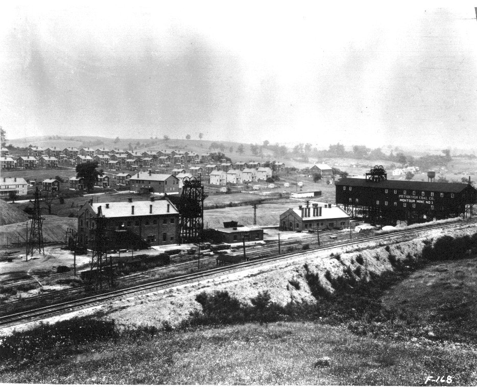
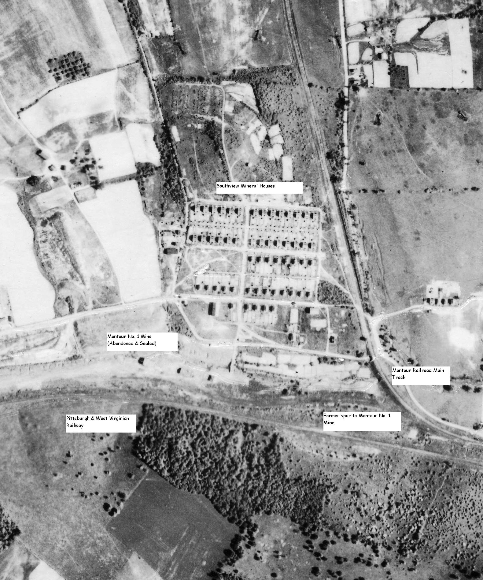
No.1 Mine was located at Southview, PA, west of Venice off of PA Route
50 and between McDonald Viaduct and Gilmore Junction on the Montour
Railroad. Montour No. 1 was one of three new mines the Pittsburgh
Coal Company opened as the railroad constructed its Mifflin Extension
in 1914. Men and supplies for the new mine were delivered by the
Wabash Pittsburgh Terminal Railroad at George Station west of Venice
Siding. (George will be The
exact date when Montour No. 1 closed is not known. The mine is
listed in the PA Bureau of Mines annual report for 1932, but looks
abandoned in the 1939 aerial photos of Southview. Montour No. 1 was a
shaft mine that was about 100 feet deep. The coal seam was mined
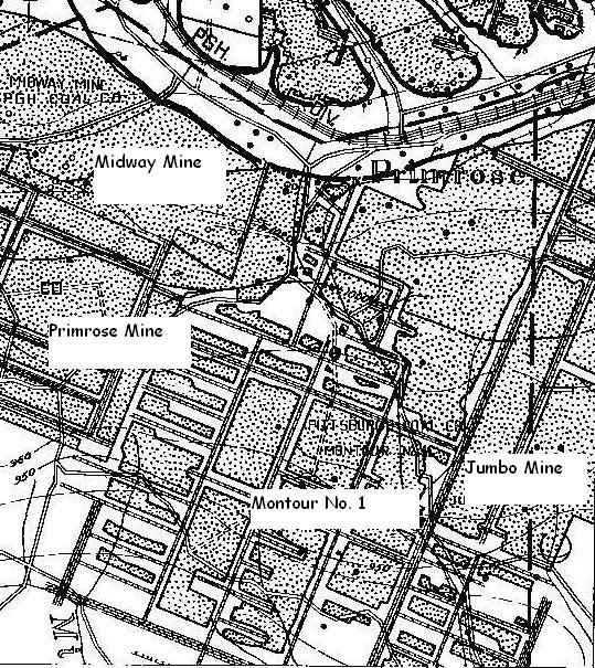
toward the north. Montour No. 1 abutted the Primrose Mine on the
northwest and the Jumbo Mine on the northeast. It is believed
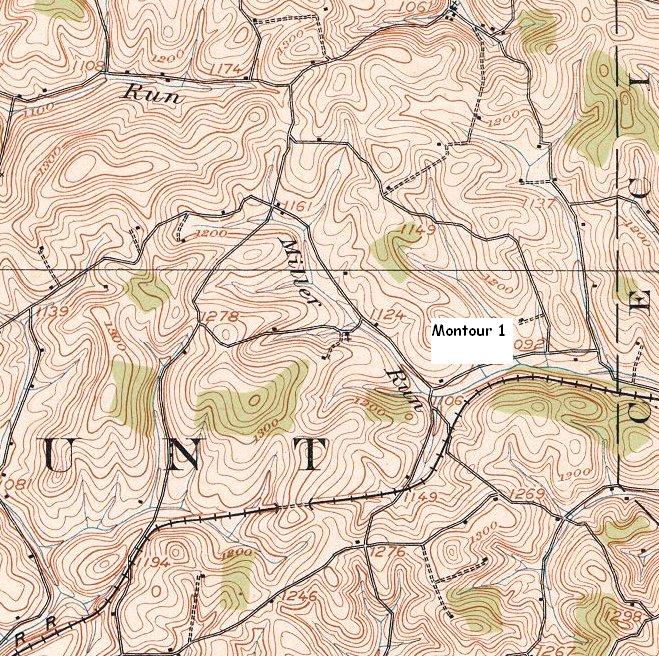
that miners living in the McDonald area could access Here are the maps for No. 1 Mine. Coal seam was between 950 and 930 MSL, dipping to the south. That's why Montour No.1 was the first shaft mine on the Montour. Ground elevation near Southview was around 1090, so the mine was probably 100 feet deep and followed the seam up-dip to the north. It abutted Primrose and Jumbo mines, which were drift entries. Montour #1 was opened around 1914 according to the 1913 Penna Bureau of Mines Annual Report. The report states 'Montour 1, 2 and 4, new shafts open just down to the coal.
|