 Montour Railroad
|
|
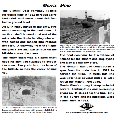
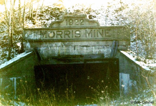
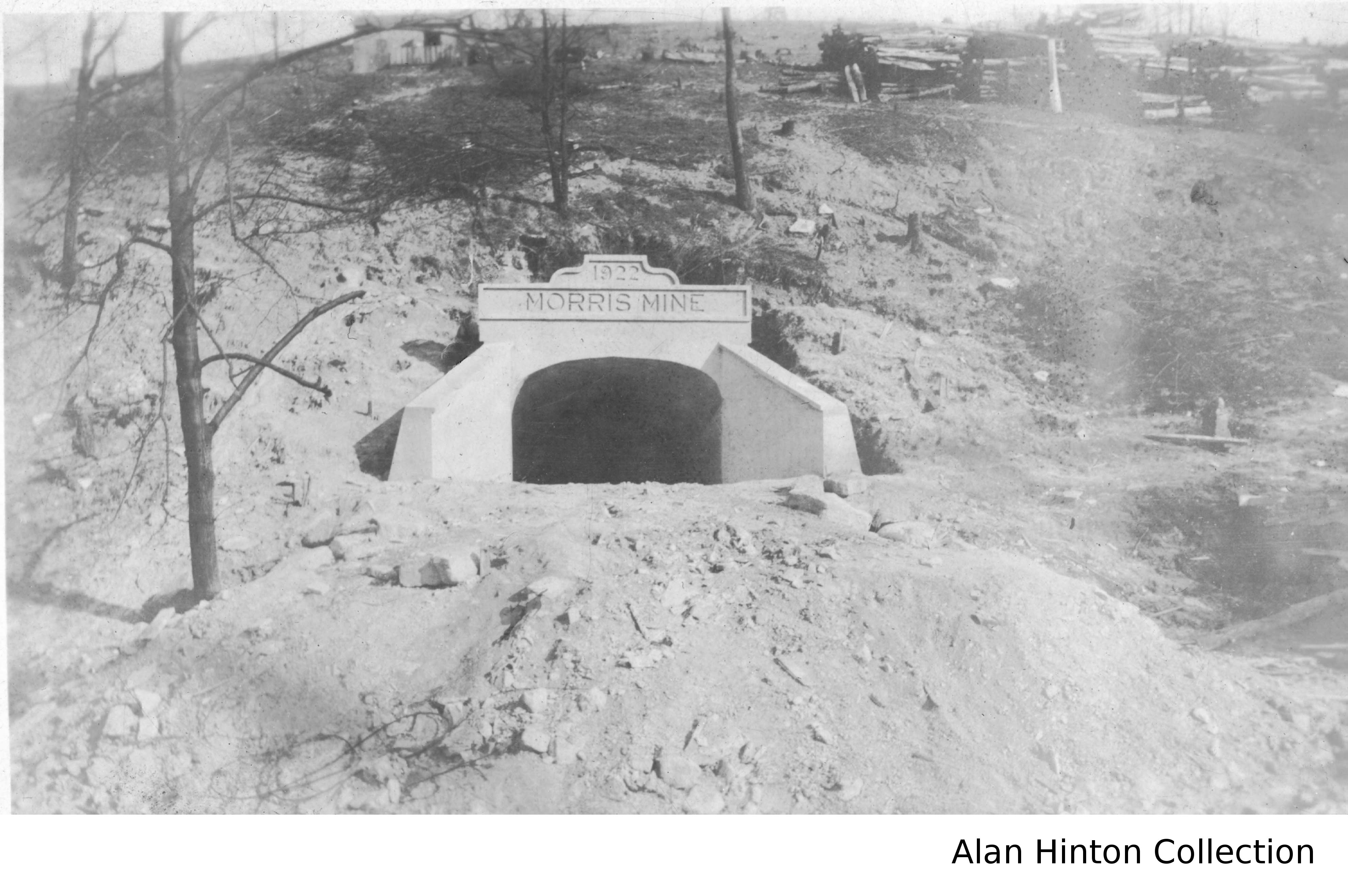
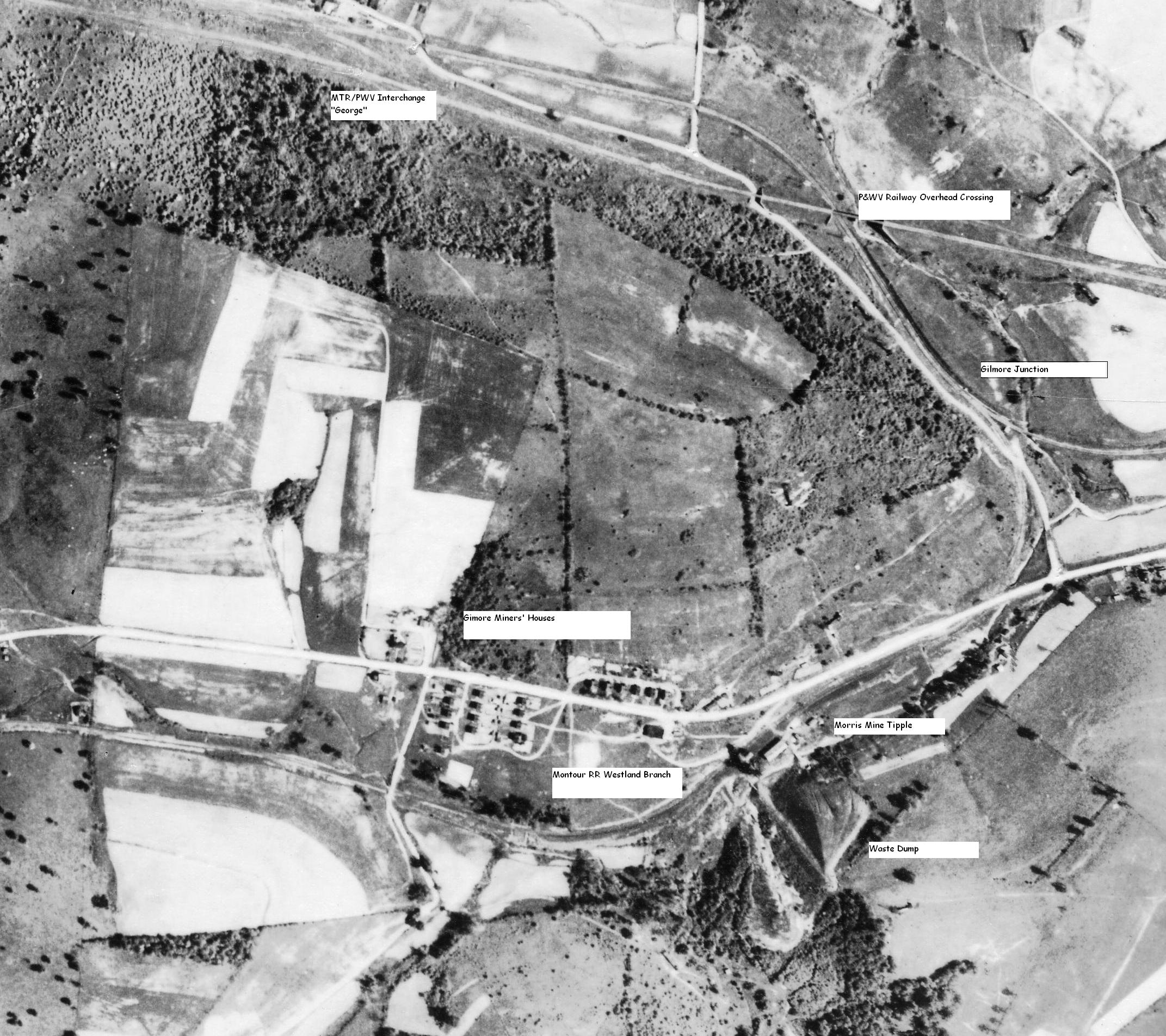
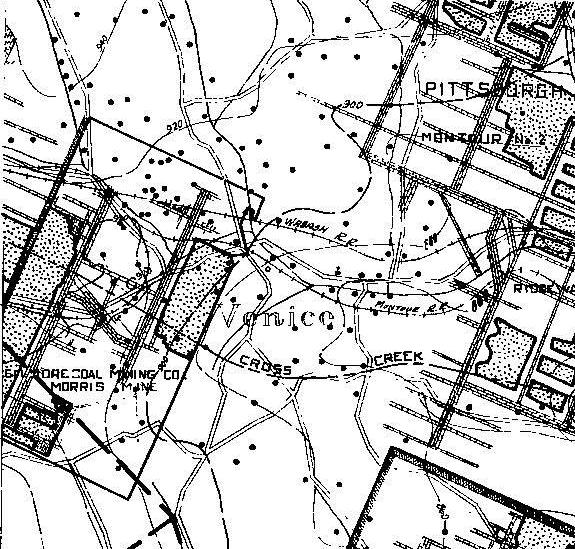
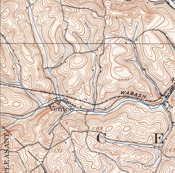
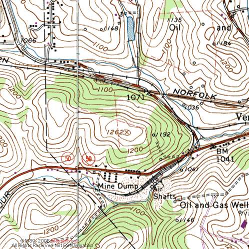
Morris Mine Bob Ciminels' Report on the Morris Mine. The Morris Mine was located on the Montour Railroad’s Midland Spur (Westland Branch) timetable east of Southview. Trains reached Morris Mine via Gilmore Junction, named for the Gilmore Coal Company who built the mine. The mine was on the south side of Route 50 northof Millers Run. The village of Gilmore was located on the hillside north of the mine. Morris
Mine shows up in the 1940, 1947 and 1968 timetables, but the 1977
timetable only contains rules for protecting the crossing at Route 50
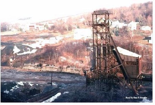
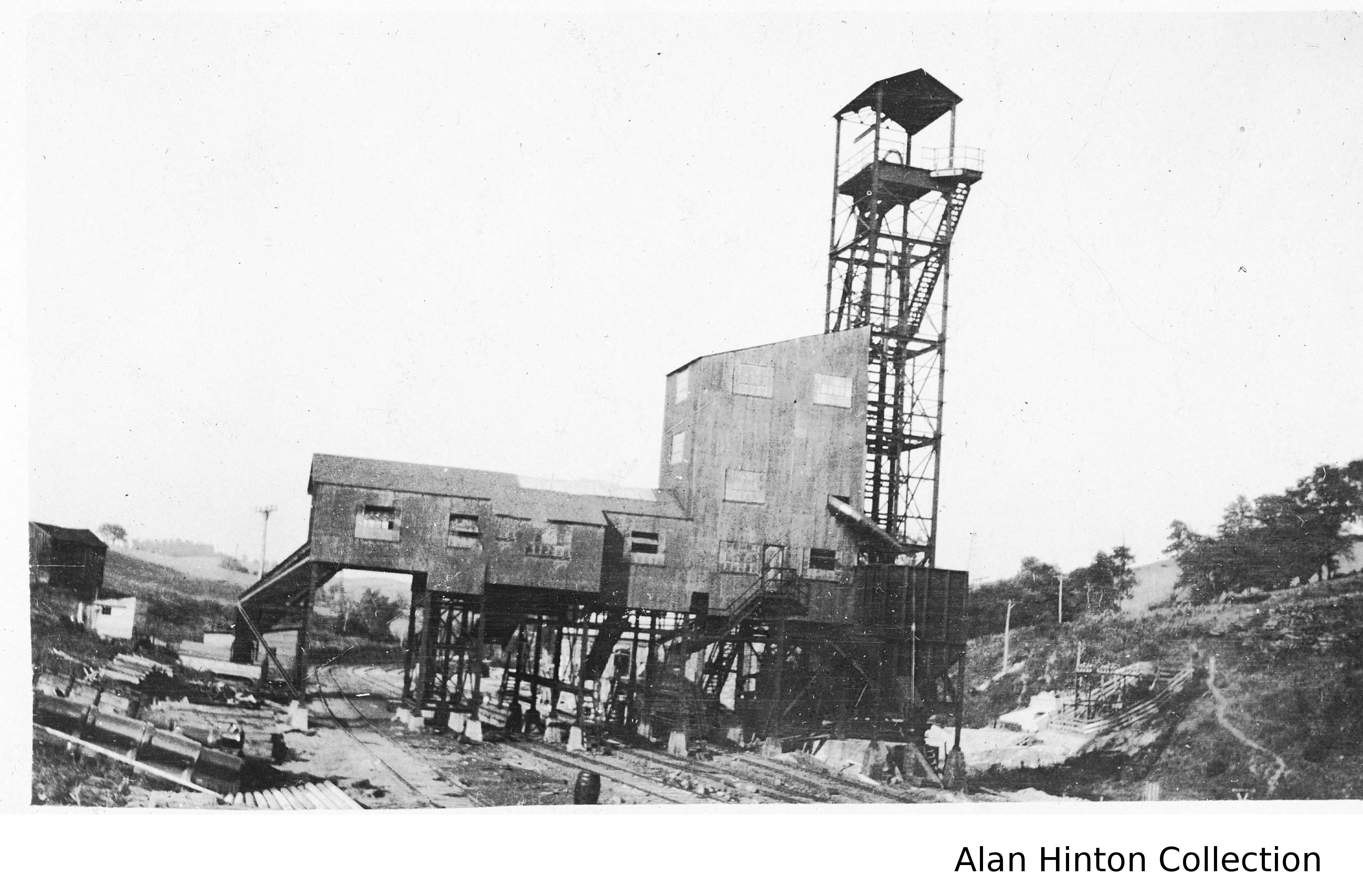
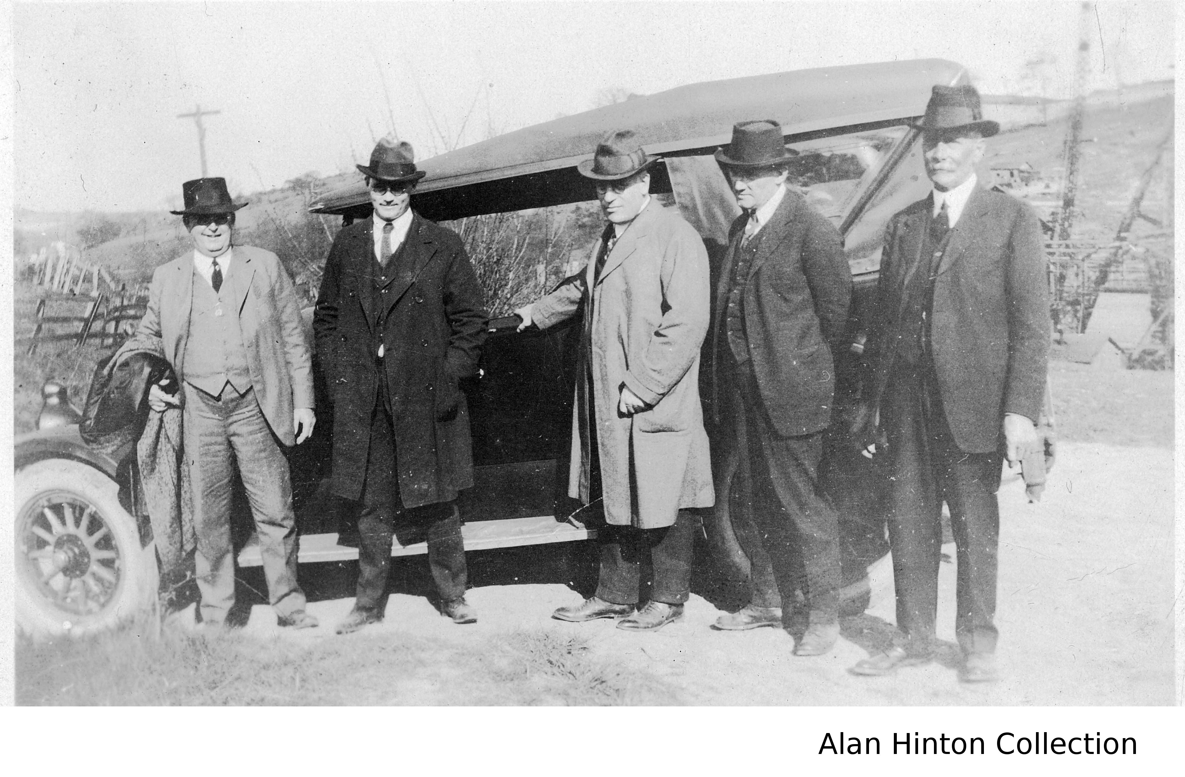
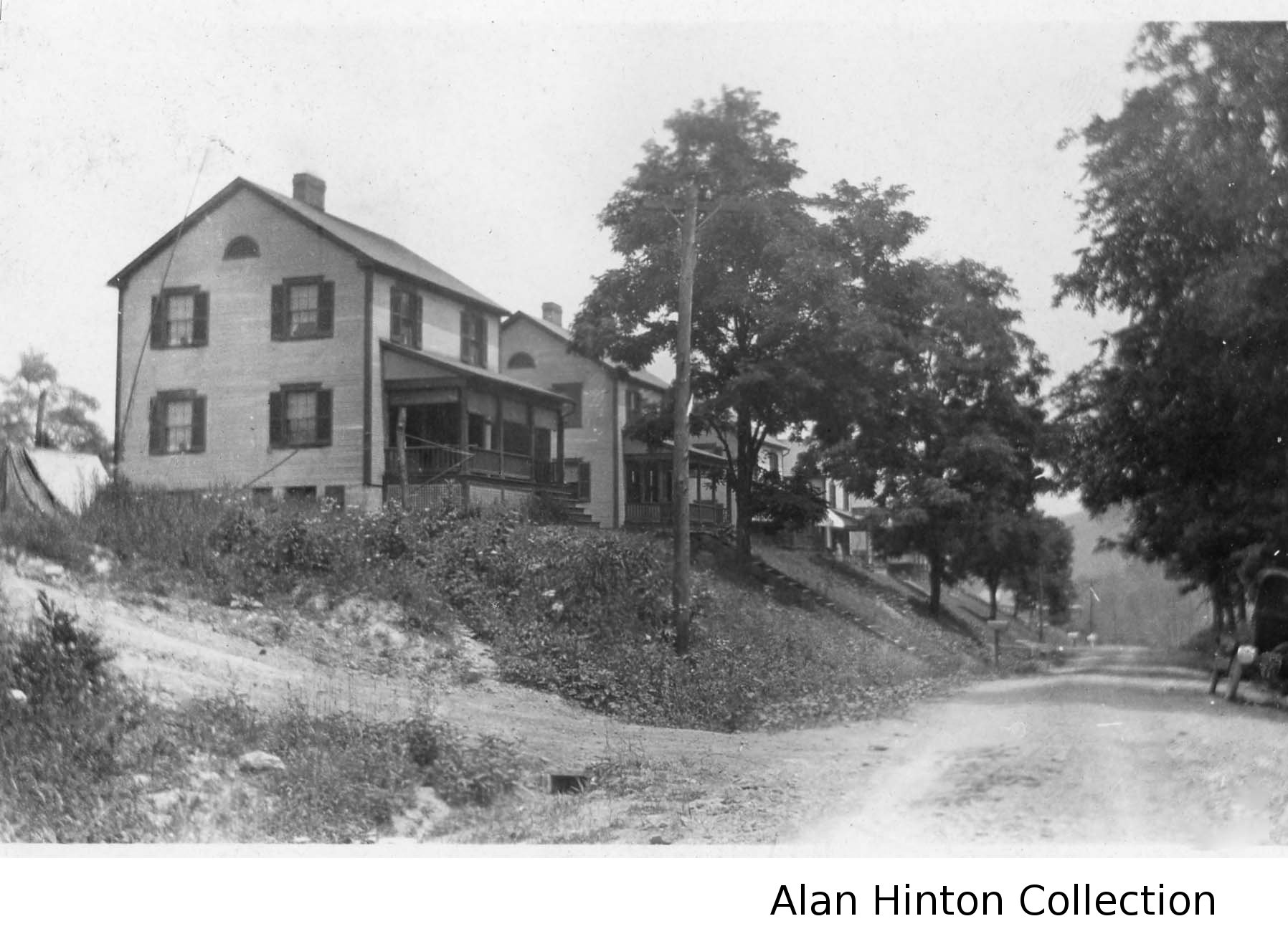
(formerly Route 28). Here is Tim Sposato's story on the Morris Mine BBQ. The seam at Morris Mine was between 900 and 920. Both Morris and Montour No. 1 were located on the north side of the Cross Creek Syncline, which is why the coal was deeper. Surface elevation at Morris was about 1080, making it around 160 to 180 feet deep. If you assume the slope entry was at an angle of 30 degrees, that would make it around 360 feet long. It was probably less steep than 30 degrees. Morris tipple was dynamited on November 16, 1982 using plastic explosives. It took 3 separate attempts as both the 1st and 2nd made a loud bang, knocked a ton of dust loose, but did not bring down the tipple. Finally the 3rd attempt actually had the tipple lean to its one side, but not totally collapse. A steel cable and a buldozer finally knocked the life out of that old rusted hulk and down she finally came.I was thinking Westland should be the final mine along the Montour R.R. but after a quick notebook check...and of course it depends on if we are talking just coal mines...or does this include Champion Preparation Plant "Tipple"...? But I photographed Champion Preparation Plant on April 24, 1989 about a year or so before it was torn down. - Gene P. Schaeffer There are more photos of the Morris Mine area here. About the Alan Hinton photograhs. The photos of the Morris Mine and adjacent Gilmore patch town in Cecil Township PA are from 1922 (when it opened). My great grandfather, John Lose, along with his family traveled from Windber PA to build the patch town. The images are from the photo album of my grandmother, Iva Mae Lose Hinton. - Bob Ciminel Click on the images to get a high
resolution view.
|
|||||||||||||||||||||||||