 Montour Railroad
|
|
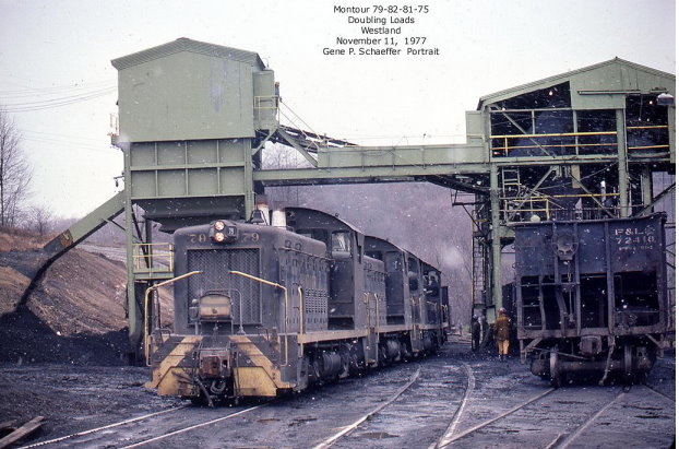
Westland Mine Read Bob Ciminel's Report on the Westland Mine. The
Westland No. 1 Mine was located at Milepost 26.32 on the Montour's
Westland Branch, 3.76 miles from Gilmore Junction. It was
designated Station 112 in the Montour timetables. In the 1968
timetable, Westland Branch was designated a Secondary Track of no
assigned direction and extra trains could operate on the branch without
train orders between Gilmore Junction and Westland. Timetable
direction between Gilmore Junction and Westland was eastward.
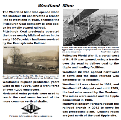
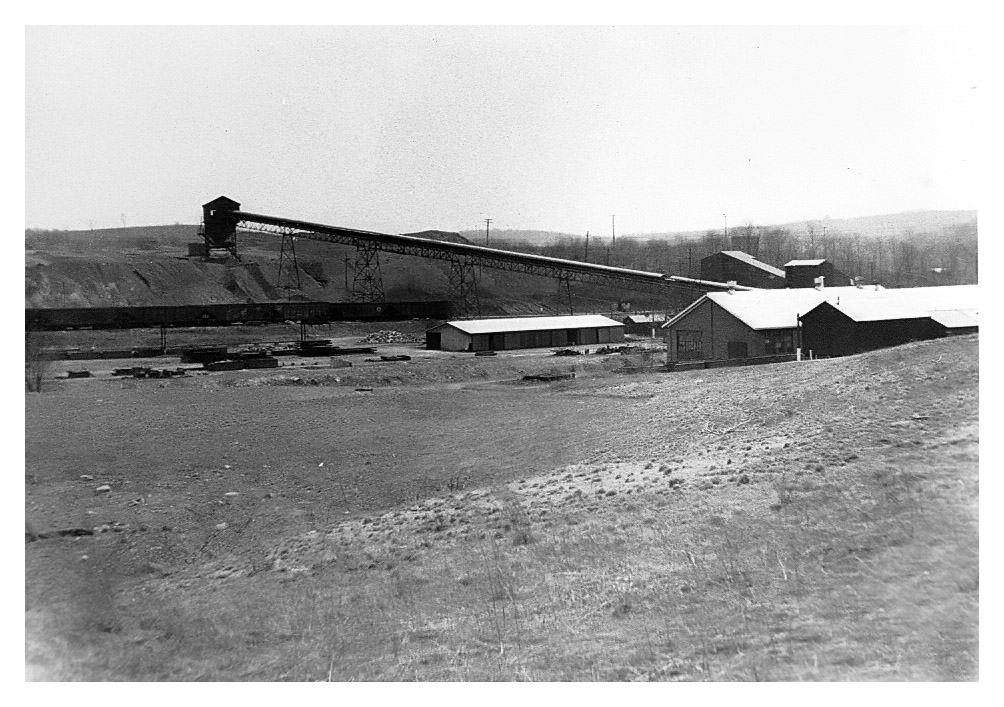
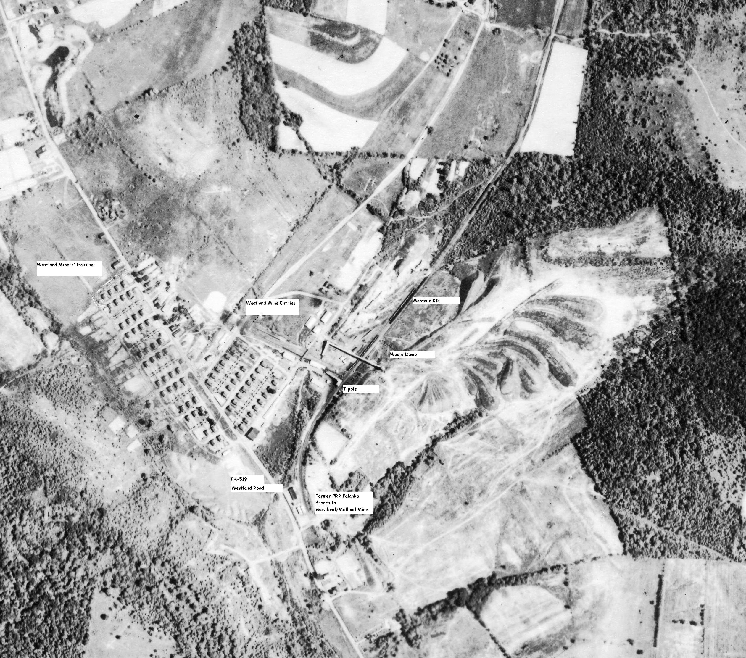
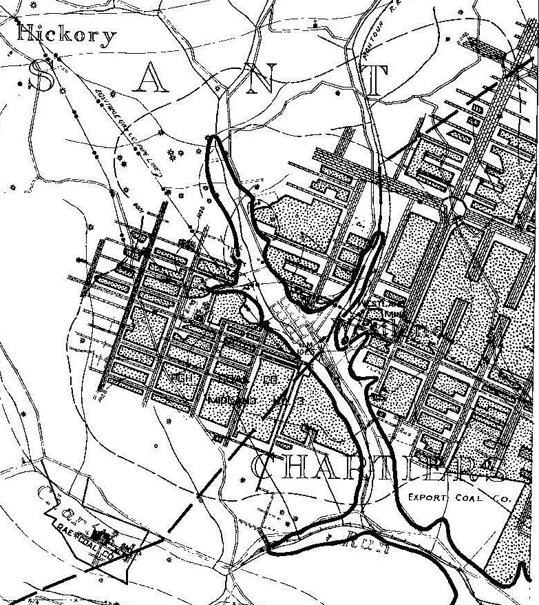
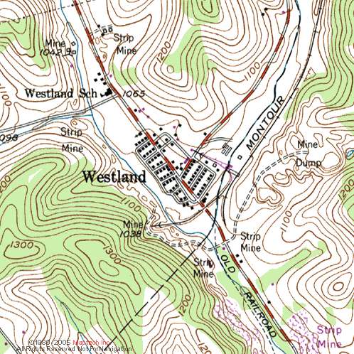
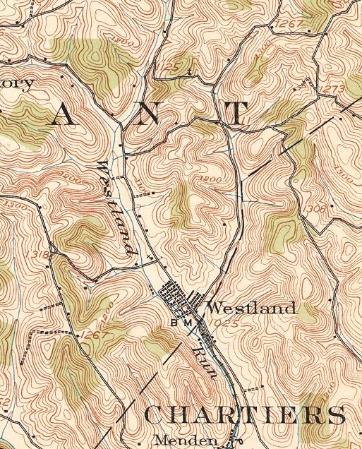
In 1977, the branch was still listed as the Westland Secondary Track and yard limits were in effect from 100 feet west of Gilmore Junction to Route 50. Westland Mine No. 1 was owned by the Pittsburgh Coal Company and located at the eastern (timetable) end of the Montour Railroad’s Midland Spur/Westland Branch, just east of Route 519 at the aptly named community of Westland. It was adjacent to the Midland No. 2 Mine on the east and the Arden Mine on the south. The exact date when Westland No. 1 opened is not known, but it was concurrent with the completion of the Montour Westland Branch in 1928. An article in Coal Age magazine in 1916 reported that the Pittsburgh Coal Company was opening two mines at Westland that had been closed for two years. In all likelihood, these were the Midland No. 1 and 2 mines since the Montour Westland Branch had not been built yet.
Here are the maps for Westland
Mine. Note that Westland was on the south side of the Cross Creek
Syncline and the coal seam is back up to almost 1100 MSL. That's why
Westland had horizontal entries instead of a shaft. I'm pretty sure the
two surface entries were only for mantrips and supplies. It looks like
the car dump was underground and the coal was lifted to the surface on
conveyor belts.
Click on the images to get a high resolution view.
|